Space and Earth Observations — Publications
Accelerating Long-period Exoplanet Discovery by Combining Deep Learning and Citizen Science
Automated planetary transit detection has become vital to identify and prioritize candidates for expert analysis and verification given the scale of modern telescopic surveys. Current methods for short-period exoplanet detection work effectively due to periodicity in the transit signals, but a robust approach for detecting single-transit events is lacking. However, volunteer-labeled transits collected by the Planet Hunters TESS (PHT) project now provide an unprecedented opportunity to investigate a data-driven approach to long-period exoplanet detection. In this work, we train a 1D convolutional neural network to classify planetary transits using PHT volunteer scores as training data. We find that this model recovers planet candidates (TESS objects of interest; TOIs) at a precision and recall rate exceeding those of volunteers, with a 20% improvement in the area under the precision-recall curve and 10% more TOIs identified in the top 500 predictions on average per sector. Import... [full abstract]
Shreshth Malik, Nora L. Eisner, Ian R. Mason, Sofia Platymesi, Suzanne Aigrain, Steven J. Roberts, Yarin Gal, Chris J. Lintott
The Astronomical Journal
[paper]
High-Cadence Thermospheric Density Estimation enabled by Machine Learning on Solar Imagery
Accurate estimation of thermospheric density is critical for precise modeling of satellite drag forces in low Earth orbit (LEO). Improving this estimation is crucial to tasks such as state estimation, collision avoidance, and re-entry calculations. The largest source of uncertainty in determining thermospheric density is modeling the effects of space weather driven by solar and geomagnetic activity. Current operational models rely on ground-based proxy indices which imperfectly correlate with the complexity of solar outputs and geomagnetic responses. In this work, we directly incorporate NASA’s Solar Dynamics Observatory (SDO) extreme ultraviolet (EUV) spectral images into a neural thermospheric density model to determine whether the predictive performance of the model is increased by using space-based EUV imagery data instead of, or in addition to, the ground-based proxy indices. We demonstrate that EUV imagery can enable predictions with much higher temporal resolution and rep... [full abstract]
Shreshth Malik, James Walsh, Giacomo Acciarini, Thomas E. Berger, Atılım Güneş Baydin
Machine Learning and the Physical Sciences workshop, NeurIPS 2023
[paper]
Orbit-to-ground framework to decode and predict biosignature patterns in terrestrial analogues
In the search for biosignatures on Mars, there is an abundance of data from orbiters and rovers to characterize global and regional habitability, but much less information is available at the scales and resolutions of microbial habitats and biosignatures. Understanding whether the distribution of terrestrial biosignatures is characterized by recognizable and predictable patterns could yield signposts to optimize search efforts for life on other terrestrial planets. We advance an adaptable framework that couples statistical ecology with deep learning to recognize and predict biosignature patterns at nested spatial scales in a polyextreme terrestrial environment. Drone flight imagery connected simulated HiRISE data to ground surveys, spectroscopy and biosignature mapping to reveal predictable distributions linked to environmental factors. Artificial intelligence–machine learning models successfully identified geologic features with high probabilities for containing biosignatures a... [full abstract]
Kimberley Warren-Rhodes, Nathalie A. Cabrol, Michael Phillips, Cinthya Tebes-Cayo, Freddie Kalaitzis, Diego Ayma, Cecilia Demergasso, Guillermo Chong-Diaz, Kevin Lee, Nancy Hinman, Kevin L. Rhodes, Linda Ng Boyle, Janice L. Bishop, Michael H. Hofmann, Neil Hutchinson, Camila Javiera, Jeffrey Moersch, Claire Mondro, Nora Nofke, Victor Parro, Connie Rodriguez, Pablo Sobron, Philippe Sarazzin, David Wettergreen, the SETI Institute NAI Team
Nature Astronomy
[paper]
Discovering Long-period Exoplanets using Deep Learning with Citizen Science Labels
Automated planetary transit detection has become vital to prioritize candidates for expert analysis given the scale of modern telescopic surveys. While current methods for short-period exoplanet detection work effectively due to periodicity in the light curves, there lacks a robust approach for detecting single-transit events. However, volunteer-labelled transits recently collected by the Planet Hunters TESS (PHT) project now provide an unprecedented opportunity to investigate a data-driven approach to long-period exoplanet detection. In this work, we train a 1-D convolutional neural network to classify planetary transits using PHT volunteer scores as training data. We find using volunteer scores significantly improves performance over synthetic data, and enables the recovery of known planets at a precision and rate matching that of the volunteers. Importantly, the model also recovers transits found by volunteers but missed by current automated methods.
Shreshth Malik, Nora L. Eisner, Chris J. Lintott, Yarin Gal
Machine Learning and the Physical Sciences workshop, NeurIPS 2022
[paper]
Multi-Spectral Multi-Image Super-Resolution of Sentinel-2 with Radiometric Consistency Losses and Its Effect on Building Delineation
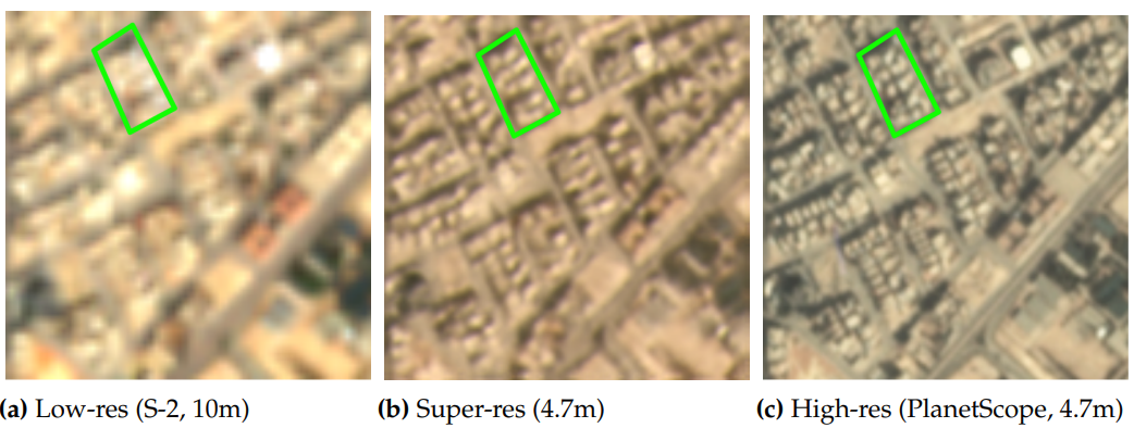
High resolution remote sensing imagery is used in broad range of tasks, including detection and classification of objects. High-resolution imagery is however expensive, while lower resolution imagery is often freely available and can be used by the public for range of social good applications. To that end, we curate a multi-spectral multi-image super-resolution dataset, using PlanetScope imagery from the SpaceNet 7 challenge as the high resolution reference and multiple Sentinel-2 revisits of the same imagery as the low-resolution imagery. We present the first results of applying multi-image super-resolution (MISR) to multi-spectral remote sensing imagery. We, additionally, introduce a radiometric consistency module into MISR model the to preserve the high radiometric resolution of the Sentinel-2 sensor. We show that MISR is superior to single-image super-resolution and other baselines on a range of image fidelity metrics. Furthermore, we conduct the first assessment of the util... [full abstract]
Muhammed Razzak, Gonzalo Mateo-Garcia, Gurvan Lecuyer, Luis Gomez-Chova, Yarin Gal, Freddie Kalaitzis
Journal of Photogrammetry and Remote Sensing (Jan 2023)
[Paper] [BibTex]
Exploring the Limits of Synthetic Creation of Solar EUV Images via Image-to-image Translation
The Solar Dynamics Observatory (SDO), a NASA multispectral decade-long mission that has been daily producing terabytes of observational data from the Sun, has been recently used as a use case to demonstrate the potential of machine-learning methodologies and to pave the way for future deep space mission planning. In particular, the idea of using image-to-image translation to virtually produce extreme ultraviolet channels has been proposed in several recent studies, as a way to both enhance missions with fewer available channels and to alleviate the challenges due to the low downlink rate in deep space. This paper investigates the potential and the limitations of such a deep learning approach by focusing on the permutation of four channels and an encoder–decoder based architecture, with particular attention to how morphological traits and brightness of the solar surface affect the neural network predictions. In this work we want to answer the question: can synthetic images of the... [full abstract]
Valentina Salvatelli, Luiz F. G. dos Santos, Souvik Bose, Brad Neuberg, Mark C. M. Cheung, Miho Janvier, Meng Jin, Yarin Gal, Atılım Güneş Baydin
The Astrophysics Journal
[Paper]
Open High-Resolution Satellite Imagery; The WorldStrat Dataset - With Application to Super-Resolution
Analyzing the planet at scale with satellite imagery and machine learning is a dream that has been constantly hindered by the cost of difficult-to-access highlyrepresentative high-resolution imagery. To remediate this, we introduce here the WorldStratified dataset. The largest and most varied such publicly available dataset, at Airbus SPOT 6/7 satellites’ high resolution of up to 1.5 m/pixel, empowered by European Space Agency’s Phi-Lab as part of the ESA-funded QueryPlanet project, we curate nearly 10,000 km² of unique locations to ensure stratified representation of all types of land-use across the world: from agriculture to ice caps, from forests to multiple urbanization densities. We also enrich those with locations typically under-represented in ML datasets: sites of humanitarian interest, illegal mining sites, and settlements of persons at risk. We temporally-match each highresolution image with multiple low-resolution images from the freely accessible lower-resolution Sen... [full abstract]
Julien Cornebise, Ivan Oršolić, Freddie Kalaitzis
arXiv
[paper]
Global Geomagnetic Perturbation Forecasting Using Deep Learning
Geomagnetically Induced Currents (GICs) arise from spatio-temporal changes to Earth’s magnetic field, which arise from the interaction of the solar wind with Earth’s magnetosphere, and drive catastrophic destruction to our technologically dependent society. Hence, computational models to forecast GICs globally with large forecast horizon, high spatial resolution and temporal cadence are of increasing importance to perform prompt necessary mitigation. Since GIC data is proprietary, the time variability of the horizontal component of the magnetic field perturbation (dB/dt) is used as a proxy for GICs. In this work, we develop a fast, global dB/dt forecasting model, which forecasts 30 min into the future using only solar wind measurements as input. The model summarizes 2 hr of solar wind measurement using a Gated Recurrent Unit and generates forecasts of coefficients that are folded with a spherical harmonic basis to enable global forecasts. When deployed, our model produces result... [full abstract]
Vishal Upendran, Panagiotis Tigas, Banafsheh Ferdousi, Téo Bloch, Mark C. M. Cheung, Siddha Ganju, Asti Bhatt, Ryan M. McGranaghan, Yarin Gal
Space Weather
[paper]
On Transfer Learning for Building Damage Assessment from Satellite Imagery in Emergency Contexts
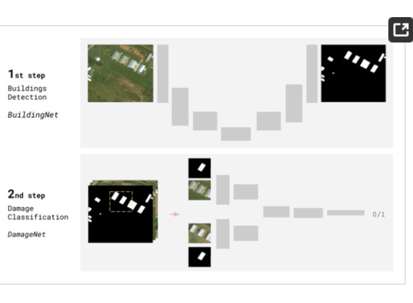
When a natural disaster occurs, humanitarian organizations need to be prompt, effective, and efficient to support people whose security is threatened. Satellite imagery offers rich and reliable information to support expert decision-making, yet its annotation remains labour-intensive and tedious. In this work, we evaluate the applicability of convolutional neural networks (CNN) in supporting building damage assessment in an emergency context. Despite data scarcity, we develop a deep learning workflow to support humanitarians in time-constrained emergency situations. To expedite decision-making and take advantage of the inevitable delay to receive post-disaster satellite images, we decouple building localization and damage classification tasks into two isolated models. Our contribution is to show the complexity of the damage classification task and use established transfer learning techniques to fine-tune the model learning and estimate the minimal number of annotated samples req... [full abstract]
Isabelle Bouchard, Marie-Ève Rancourt, Daniel Aloise, Freddie Kalaitzis
Remote Sensing
[paper]
Time-dependent Hillshades; Dispelling the Shadow Curse of Machine Learning Applications in Earth Observation
We show that machine learning models learn and perform better when they know where to expect shadows, through hillshades modeled to the time of imagery acquisition.Shadows are detrimental to all machine learning applications on satellite imagery. Prediction tasks like semantic / instance segmentation, object detection, counting of rivers, roads, buildings, trees, all rely on crisp edges and colour gradients that are confounded by the presence of shadows in passive optical imagery, which rely on the sun’s illumination for reflectance values.Hillshading is a standard technique for enriching a mapped terrain with relief effects, which is done by emulating the shadow caused by steep terrain and/or tall vegetation. A hillshade that is modeled to the time of day and year can be easily derived through a basic form of ray tracing on a Digital Terrain Model (DTM) (also known as a bare-earth DEM) or Digital Surface Model (DSM) given the sun’s altitude and azimuth angles. In this work, we ... [full abstract]
Freddie Kalaitzis, Gonzalo Mateo-Garcia, Kevin Dobbs, Dolores Garcia, Jason Stoker, Giovanni Marchisio
Earth Observation, EGU General Assembly 2022
[paper]
Solar EUV-Enhancement and Thermospheric Disturbances
The increase of energetic electromagnetic flux during solar flares and particle precipitation during geomagnetic activity are among the most important sources of neutral density disturbances to the Earth’s thermosphere. However, disentangling the role of X and EUV radiation during solar flares is difficult due to the rarity of sufficiently isolated EUV-enhancements. Past work investigating the role of EUV-enhancements has been based on simulations only. This study focuses on the analysis of the response of the thermosphere to relatively long-lasting (between 1 and 2 days) EUV-enhancements. These events take place in isolation from coronal mass ejections, but often occur during the recovery phase of flare events. Using the Gravity Recovery and Climate Experiment and Challenging Minisatellite Payload accelerometer-derived density datasets, we show that the EUV-enhancements slow the thermosphere’s recovery from a flare, and maintain a high level density perturbation “plateau” lasti... [full abstract]
C Briand, Kelsey Doerksen, F Deleflie
Space Weather, Vol. 19, Issue 12
[Paper]
Physics informed deep learning to super-resolve and cross-calibrate solar magnetograms
Super-resolution techniques aim to increase the resolution of images by adding detail. Compared to upsampling techniques reliant on interpolation, deep learning-based approaches learn features and their relationships across the training data set to leverage prior knowledge on what low resolution patterns look like in higher resolution images. As an added benefit, deep neural networks can learn the systematic properties of the target images (ie texture), combining super-resolution with instrument cross-calibration. While the successful use of super-resolution algorithms for natural images is rooted in creating perceptually convincing results, super-resolution applied to scientific data requires careful quantitative evaluation of performances. In this work, we demonstrate that deep learning can increase the resolution and calibrate space-and ground-based imagers belonging to different instrumental generations. In addition, we establish a set of measurements to benchmark the perfor... [full abstract]
Andres Munoz-Jaramillo, Anna Jungbluth, Xavier Gitiaux, Paul Wright, Carl Shneider, Shane Maloney, Atılım Güneş Baydin, Yarin Gal, Michel Deudon, Freddie Kalaitzis
Research Square
[Paper]
Shifts: A Dataset of Real Distributional Shift Across Multiple Large-Scale Tasks
There has been significant research done on developing methods for improving robustness to distributional shift and uncertainty estimation. In contrast, only limited work has examined developing standard datasets and benchmarks for assessing these approaches. Additionally, most work on uncertainty estimation and robustness has developed new techniques based on small-scale regression or image classification tasks. However, many tasks of practical interest have different modalities, such as tabular data, audio, text, or sensor data, which offer significant challenges involving regression and discrete or continuous structured prediction. Thus, given the current state of the field, a standardized large-scale dataset of tasks across a range of modalities affected by distributional shifts is necessary. This will enable researchers to meaningfully evaluate the plethora of recently developed uncertainty quantification methods, as well as assessment criteria and state-of-the-art baselin... [full abstract]
Andrey Malinin, Neil Band, Alexander Ganshin, German Chesnokov, Yarin Gal, Mark J. F. Gales, Alexey Noskov, Andrey Ploskonosov, Liudmila Prokhorenkova, Ivan Provilkov, Vatsal Raina, Vyas Raina, Denis Roginskiy, Mariya Shmatova, Panagiotis Tigas, Boris Yangel
NeurIPS Datasets and Benchmarks Track, 2021
[arXiv] [BibTex] [Code]
[Competition Website] [Blog Post (OATML)] [Blog Post (Yandex Research)]
Galaxy Zoo DECaLS: Detailed visual morphology measurements from volunteers and Deep Learning for 314,000 galaxies
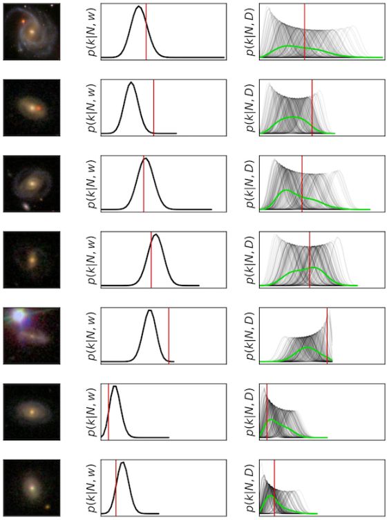
We present Galaxy Zoo DECaLS: detailed visual morphological classifications for Dark Energy Camera Legacy Survey images of galaxies within the SDSS DR8 footprint. Deeper DECaLS images (r = 23.6 versus r = 22.2 from SDSS) reveal spiral arms, weak bars, and tidal features not previously visible in SDSS imaging. To best exploit the greater depth of DECaLS images, volunteers select from a new set of answers designed to improve our sensitivity to mergers and bars. Galaxy Zoo volunteers provide 7.5 million individual classifications over 314 000 galaxies. 140 000 galaxies receive at least 30 classifications, sufficient to accurately measure detailed morphology like bars, and the remainder receive approximately 5. All classifications are used to train an ensmble of Bayesian convolutional neural networks (a state-of-the-art deep learning method) to predict posteriors for the detailed morphology of all 314 000 galaxies. We use active learning to focus our volunteer effort on the galaxies... [full abstract]
Mike Walmsley, Chris Lintott, Tobias Géron, Sandor Kruk, Coleman Krawczyk, Kyle W Willett, Steven Bamford, Lee S Kelvin, Lucy Fortson, Yarin Gal, William Keel, Karen L Masters, Vihang Mehta, Brooke D Simmons, Rebecca Smethurst, Lewis Smith, Elisabeth M Baeten, Christine Macmillan
Monthly Notices of the Royal Astronomical Society
[Paper]
Cross-calibration, super-resolution, and uncertainty estimation of the conversion of MDI and GONG to HMI full-disk magnetograms using deep learning
Over the past 50 years, a variety of instruments have obtained images of the Sun’s magnetic field (magnetograms) to study its origin and evolution. While improvements in instrumentation have led to breakthroughs in our understanding of physical phenomena, differences between subsequent instruments such as resolution, noise, and saturation levels all introduce inhomogeneities into long-term data sets. This has proven to be an insurmountable obstacle for research applications that require high-resolution and homogeneous data spanning time frames longer than the lifetime of a single instrument.
Here we show that deep-learning-based super-resolution techniques can successfully up-sample and homogenize solar magnetic field images obtained both by space and ground-based instruments. In particular, we show the results of cross-calibrating and super-resolving MDI and GONG magnetograms to the characteristics of HMI. We also discuss the importance of agreeing on a standardized set... [full abstract]
A Munoz-Jaramillo, A Jungbluth, X Gitiaux, P Wright, C Shneider, S Maloney, Freddie Kalaitzis, Atılım Güneş Baydin, Yarin Gal, M Deudon
Bulletin of the American Astronomical Society
[paper]
Kessler : A machine learning library for spacecraft collision avoidance
As megaconstellations are launched and the space sector grows, space debris pollution is posing an increasing threat to operational spacecraft. Low Earth orbit is a junkyard of dead satellites, rocket bodies, shrapnels, and other debris that travel at very high speed in an uncontrolled manner. Collisions at orbital speeds can generate fragments and potentially trigger a cascade of more collisions endangering the whole population, a scenario known since the late 1970s as the Kessler syndrome. In this work we present Kessler: an open-source Python package for machine learning (ML) applied to collision avoidance. Kessler provides functionalities to import and export conjunction data messages (CDMs) in their standard format and predict the evolution of conjunction events based on explainable ML models. In Kessler we provide Bayesian recurrent neural networks that can be trained with existing collections of CDM data and then deployed in order to predict the contents of future CDMs in... [full abstract]
Giacomo Acciarini, Francesco Pinto, Francesca Letizia, José A. Martinez-Heras, Klaus Merz, Christopher Bridges, Atılım Güneş Baydin
8th European Conference on Space Debris
[Paper]
Towards global flood mapping onboard low cost satellites with machine learning
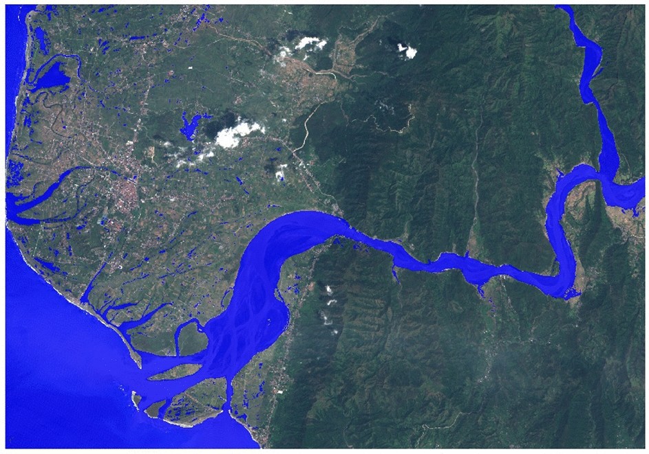
Spaceborne Earth observation is a key technology for flood response, offering valuable information to decision makers on the ground. Very large constellations of small, nano satellites— ’CubeSats’ are a promising solution to reduce revisit time in disaster areas from days to hours. However, data transmission to ground receivers is limited by constraints on power and bandwidth of CubeSats. Onboard processing offers a solution to decrease the amount of data to transmit by reducing large sensor images to smaller data products. The ESA’s recent PhiSat-1 mission aims to facilitate the demonstration of this concept, providing the hardware capability to perform onboard processing by including a power-constrained machine learning accelerator and the software to run custom applications. This work demonstrates a flood segmentation algorithm that produces flood masks to be transmitted instead of the raw images, while running efficiently on the accelerator aboard the PhiSat-1. Our models ar... [full abstract]
Gonzalo Mateo-Garcia, Joshua Veitch-Michealis, Lewis Smith, Silviu Oprea, Guy Schumann, Yarin Gal, Atılım Güneş Baydin, Dietmar Backes
Nature Scientific Reports, 2021
[Paper]
Water monitoring with Very High Resolution satellite imagery
The water volume on Earth’s surface constantly varies with precipitation: an excess of water might lead to flooding, while its absence indicates upcoming droughts. We cannot afford in-situ monitoring devices on all rivers and streams worldwide, and free satellite imagery lacks the spatial and temporal resolution for continuous monitoring. This talk will provide several examples of water monitoring using PlanetScope daily imagery. The global daily coverage of Planet’s data presents new opportunities for developing robust models of flood hazard, providing timely mapping in support of relief operations, and applying near real time predictive models for river flow estimation based on simultaneous measurements over entire river basins.
Freddie Kalaitzis, Gonzalo Mateo Garcia, Giovanni Marchisio
EGU General Assembly Conference Abstracts
[presentation]
[abstract]
Space Weather at Earth and Beyond; New Instruments, Platforms, and Initiatives for Space Weather
With the current efforts to return humans to the Moon and the longer term goal to send people to Mars, now is the time to better understand the space weather conditions and their effects beyond the near-Earth environment. During the maximum phase of the solar activity cycle, space weather events triggered by solar flares, coronal mass ejections (CMEs) and their associated solar energetic particles (SEPs) can significantly disturb the local space environments at Earth, at the Moon and at Mars. How these extreme events impact these various planetary bodies will depend on their respective plasma environments (e.g., airless, tenuous or thick atmosphere, with or without a magnetosphere). While there are fewer extreme events related to CMEs and flares during the quiescent solar cycle phase, events triggered by corotating solar wind streams become more prominent. At the same time, very high energy particles from Galactic Cosmic Rays (GCRs) significantly increase the background space ra... [full abstract]
Christina O Lee, Alec Engell, Kelsey Doerksen
18th Conference on Space Weather
[Conference]
RainBench: Towards Global Precipitation Forecasting from Satellite Imagery
Extreme precipitation events, such as violent rainfall and hail storms, routinely ravage economies and livelihoods around the developing world. Climate change further aggravates this issue. Data-driven deep learning approaches could widen the access to accurate multi-day forecasts, to mitigate against such events. However, there is currently no benchmark dataset dedicated to the study of global precipitation forecasts. In this paper, we introduce \textbf{RainBench}, a new multi-modal benchmark dataset for data-driven precipitation forecasting. It includes simulated satellite data, a selection of relevant meteorological data from the ERA5 reanalysis product, and IMERG precipitation data. We also release \textbf{PyRain}, a library to process large precipitation datasets efficiently. We present an extensive analysis of our novel dataset and establish baseline results for two benchmark medium-range precipitation forecasting tasks. Finally, we discuss existing data-driven weather for... [full abstract]
Christian Schroeder de Witt, Catherine Tong, Valentina Zantedeschi, Daniele De Martini, Freddie Kalaitzis, Matthew Chantry, Duncan Watson-Parris, Piotr Bilinski
AAAI, 2021
[arXiv]
Multi-Channel Auto-Calibration for the Atmospheric Imaging Assembly using Machine Learning
Solar activity plays a quintessential role in influencing the interplanetary medium and space-weather around the Earth. Remote sensing instruments onboard heliophysics space missions provide a pool of information about the Sun’s activity via the measurement of its magnetic field and the emission of light from the multi-layered, multi-thermal, and dynamic solar atmosphere. Extreme UV (EUV) wavelength observations from space help in understanding the subtleties of the outer layers of the Sun, namely the chromosphere and the corona. Unfortunately, such instruments, like the Atmospheric Imaging Assembly (AIA) onboard NASA’s Solar Dynamics Observatory (SDO), suffer from time-dependent degradation, reducing their sensitivity. Current state-of-the-art calibration techniques rely on periodic sounding rockets, which can be infrequent and rather unfeasible for deep-space missions. We present an alternative calibration approach based on convolutional neural networks (CNNs). We use SDO-AIA ... [full abstract]
Luiz F. G. Dos Santos, Souvik Bose, Valentina Salvatelli, Brad Neuberg, Mark C. M. Cheung, Miho Janvier, Meng Jin, Yarin Gal, Paul Boerner, Atılım Güneş Baydin
Astronomy & Astrophysics, 2021
[Paper] [arXiv]
Global Earth Magnetic Field Modeling andForecasting with Spherical Harmonics Decomposition
Modeling and forecasting the solar wind-driven global magnetic field perturbations is an open challenge. Current approaches depend on simulations of computationally demanding models like the Magnetohydrodynamics (MHD) model or sampling spatially and temporally through sparse ground-based stations (SuperMAG). In this paper, we develop a Deep Learning model that forecasts in Spherical Harmonics space, replacing reliance on MHD models and providing global coverage at oneminute cadence, improving over the current state-of-the-art which relies on feature engineering. We evaluate the performance in SuperMAG dataset (improved by 14.53%) and MHD simulations (improved by 24.35%). Additionally, we evaluate the extrapolation performance of the spherical harmonics reconstruction based on sparse ground-based stations (SuperMAG), showing that spherical harmonics can reliably reconstruct the global magnetic field as evaluated on MHD simulation
Panagiotis Tigas, Téo Bloch, Vishal Upendran, Banafsheh Ferdoushi, Yarin Gal, Siddha Ganju, Ryan M. McGranaghan, Mark C. M. Cheung, Asti Bhatt
Machine Learning and the Physical Sciences Workshop - 34th NeurIPS 2020 [Paper]
Determining new representations of “Geoeffectiveness” using deep learning - AGU 2020
Model And Data Uncertainty For Satellite Time Series Forecasting With Deep Recurrent Models
Deep Learning is often criticized as black-box method which often provides accurate predictions, but limited explanation of the underlying processes and no indication when to not trust those predictions. Equipping existing deep learning models with an (approximate) notion of uncertainty can help mitigate both these issues therefore their use should be known more broadly in the community. The Bayesian deep learning community has developed model-agnostic and easyto-implement methodology to estimate both data and model uncertainty within deep learning models which is hardly applied in the remote sensing community. In this work, we adopt this methodology for deep recurrent satellite time series forecasting, and test its assumptions on data and model uncertainty. We demonstrate its effectiveness on two applications on climate change, and event change detection and outline limitations.
Marc Rußwurm, Syed Mohsin Ali, Xiao Xiang Zhu, Yarin Gal, Marco Körner
Student Paper Competition Finalists (out of 250 submissions), IGARSS 2020
[Paper]
Using U-Nets to Create High-Fidelity Virtual Observations of the Solar Corona
Understanding and monitoring the complex and dynamic processes of the Sun is important for a number of human activities on Earth and in space. For this reason, NASA’s Solar Dynamics Observatory (SDO) has been continuously monitoring the multi-layered Sun’s atmosphere in high-resolution since its launch in 2010, generating terabytes of observational data every day. The synergy between machine learning and this enormous amount of data has the potential, still largely unexploited, to advance our understanding of the Sun and extend the capabilities of heliophysics missions. In the present work, we show that deep learning applied to SDO data can be successfully used to create a high-fidelity virtual telescope that generates synthetic observations of the solar corona by image translation. Towards this end we developed a deep neural network, structured as an encoder-decoder with skip connections (U-Net), that reconstructs the Sun’s image of one instrument channel given temporally align... [full abstract]
Valentina Salvatelli, Souvik Bose, Brad Neuberg, Luiz F. G. dos Santos, Mark Cheung, Miho Janvier, Atılım Güneş Baydin, Yarin Gal, Meng Jin
Machine Learning and the Physical Sciences Workshop (ML4PS), NeurIPS 2019
[arXiv]
Auto-Calibration of Remote Sensing Solar Telescopes with Deep Learning
As a part of NASA’s Heliophysics System Observatory (HSO) fleet of satellites,the Solar Dynamics Observatory (SDO) has continuously monitored the Sun since2010. Ultraviolet (UV) and Extreme UV (EUV) instruments in orbit, such asSDO’s Atmospheric Imaging Assembly (AIA) instrument, suffer time-dependent degradation which reduces instrument sensitivity. Accurate calibration for (E)UV instruments currently depends on periodic sounding rockets, which are infrequent and not practical for heliophysics missions in deep space. In the present work, we develop a Convolutional Neural Network (CNN) that auto-calibrates SDO/AIA channels and corrects sensitivity degradation by exploiting spatial patterns in multi-wavelength observations to arrive at a self-calibration of (E)UV imaging instruments. Our results remove a major impediment to developing future HSOmissions of the same scientific caliber as SDO but in deep space, able to observe the Sun from more vantage points than just SDO’s curren... [full abstract]
Brad Neuberg, Souvik Bose, Valentina Salvatelli, Luiz F.G. dos Santos, Mark Cheung, Miho Janvier, Atılım Güneş Baydin, Yarin Gal, Meng Jin
Machine Learning and the Physical Sciences Workshop (ML4PS), NeurIPS 2019
[arXiv]
Prediction of GNSS Phase Scintillations: A Machine Learning Approach
A Global Navigation Satellite System (GNSS) uses a constellation of satellites around the earth for accurate navigation, timing, and positioning. Natural phenomena like space weather introduce irregularities in the Earth’s ionosphere, disrupting the propagation of the radio signals that GNSS relies upon. Such disruptions affect both the amplitude and the phase of the propagated waves. No physics-based model currently exists to predict the time and location of these disruptions with sufficient accuracy and at relevant scales. In this paper, we focus on predicting the phase fluctuations of GNSS radio waves, known as phase scintillations. We propose a novel architecture and loss function to predict 1 hour in advance the magnitude of phase scintillations within a time window of plus-minus 5 minutes with state-of-the-art performance.
Kara Lamb, Garima Malhotra, Athanasios Vlontzos, Edward Wagstaff, Atılım Güneş Baydin, Anahita Bhiwandiwalla, Yarin Gal, Freddie Kalaitzis, Anthony Reina, Asti Bhatt
Machine Learning and the Physical Sciences Workshop (ML4PS), NeurIPS 2019
[arXiv]
Correlation of Auroral Dynamics and GNSS Scintillation with an Autoencoder
High energy particles originating from solar activity travel along the the Earth’s magnetic field and interact with the atmosphere around the higher latitudes. These interactions often manifest as aurora in the form of visible light in the Earth’s ionosphere. These interactions also result in irregularities in the electron density, which cause disruptions in the amplitude and phase of the radio signals from the Global Navigation Satellite Systems (GNSS), known as ‘scintillation’. In this paper we use a multi-scale residual autoencoder (Res-AE) to show the correlation between specific dynamic structures of the aurora and the magnitude of the GNSS phase scintillations (σϕ). Auroral images are encoded in a lower dimensional feature space using the Res-AE, which in turn are clustered with t-SNE and UMAP. Both methods produce similar clusters, and specific clusters demonstrate greater correlations with observed phase scintillations. Our results suggest that specific dynamic structure... [full abstract]
Kara Lamb, Garima Malhotra, Athanasios Vlontzos, Edward Wagstaff, Atılım Güneş Baydin, Anahita Bhiwandiwalla, Yarin Gal, Freddie Kalaitzis, Anthony Reina, Asti Bhatt
Machine Learning and the Physical Sciences Workshop (ML4PS), NeurIPS 2019
[arXiv]
Single-Frame Super-Resolution of Solar Magnetograms; Investigating Physics-Based Metrics & Losses
Breakthroughs in our understanding of physical phenomena have traditionally followed improvements in instrumentation. Studies of the magnetic field of the Sun, and its influence on the solar dynamo and space weather events, have benefited from improvements in resolution and measurement frequency of new instruments. However, in order to fully understand the solar cycle, high-quality data across time-scales longer than the typical lifespan of a solar instrument are required. At the moment, discrepancies between measurement surveys prevent the combined use of all available data. In this work, we show that machine learning can help bridge the gap between measurement surveys by learning to super-resolve low-resolution magnetic field images and translate between characteristics of contemporary instruments in orbit. We also introduce the notion of physics-based metrics and losses for super-resolution to preserve underlying physics and constrain the solution space of possible super-reso... [full abstract]
Anna Jungbluth, Xavier Gitiaux, Shane A.Maloney, Carl Shneider, Paul J. Wright, Freddie Kalaitzis, Michel Deudon, Atılım Güneş Baydin, Yarin Gal, Andrés Muñoz-Jaramillo
Machine Learning and the Physical Sciences Workshop (ML4PS), NeurIPS 2019
[arXiv]
Flood Detection On Low Cost Orbital Hardware
Satellite imaging is a critical technology for monitoring and responding to natural disasters such as flooding. Despite the capabilities of modern satellites, there is still much to be desired from the perspective of first response organisations like UNICEF. Two main challenges are rapid access to data, and the ability to automatically identify flooded regions in images. We describe a prototypical flood segmentation system, identifying cloud, water and land, that could be deployed on a constellation of small satellites, performing processing on board to reduce downlink bandwidth by 2 orders of magnitude. We target PhiSat-1, part of the FSSCAT mission, which is planned to be launched by the European Space Agency (ESA) near the start of 2020 as a proof of concept for this new technology.
Joshua Veitch-Michaelis, Gonzalo Mateo-Garcia, Silviu Oprea, Lewis Smith, Atılım Güneş Baydin, Dietmar Backes, Yarin Gal, Guy Schumann
Spotlight talk, Artificial Intelligence for Humanitarian Assistance and Disaster Response (AI+HADR) NeurIPS 2019 Workshop
[arXiv]
FDL: Mission Support Challenge
The Frontier Development Lab (FDL) is a National Aeronautics and Space Administration (NASA) machine learning program with the stated aim of conducting artificial intelligence research for space exploration and all humankind with support in the European program from the European Space Agency (ESA). Interdisciplinary teams of researchers and data-scientists are brought together to tackle a range of challenging, real-world problems in the space-domain. The program primarily consists of a sprint phase during which teams tackle separate problems in the spirit of ‘coopetition’. Teams are given a problem brief by real stakeholders and mentored by a range of experts. With access to exceptional computational resources, we were challenged to make a serious contribution within just eight weeks. Stated simply, our team was tasked with producing a system capable of scheduling downloads from satellites autonomously. Scheduling is a difficult problem in general, of course, complicated further... [full abstract]
Luís F. Simões, Ben Day, Vinutha M. Shreenath, Callum Wilson, Chris Bridges, Sylvester Kaczmarek, Yarin Gal
NeurIPS 2019 Workshop on Machine Learning Competitions for All
[arXiv]
Machine Learning for Generalizable Prediction of Flood Susceptibility
Flooding is a destructive and dangerous hazard and climate change appears to be increasing the frequency of catastrophic flooding events around the world. Physics-based flood models are costly to calibrate and are rarely generalizable across different river basins, as model outputs are sensitive to site-specific parameters and human-regulated infrastructure. In contrast, statistical models implicitly account for such factors through the data on which they are trained. Such models trained primarily from remotely-sensed Earth observation data could reduce the need for extensive in-situ measurements. In this work, we develop generalizable, multi-basin models of river flooding susceptibility using geographically-distributed data from the USGS stream gauge network. Machine learning models are trained in a supervised framework to predict two measures of flood susceptibility from a mix of river basin attributes, impervious surface cover information derived from satellite imagery, and h... [full abstract]
Chelsea Sidrane, Dylan J Fitzpatrick, Andrew Annex, Diane O’Donoghue, Piotr Bilinksi, Yarin Gal
Spotlight talk, Artificial Intelligence for Humanitarian Assistance and Disaster Response (AI+HADR) NeurIPS 2019 Workshop
[arXiv]
Probabilistic Super-Resolution of Solar Magnetograms: Generating Many Explanations and Measuring Uncertainties
Machine learning techniques have been successfully applied to super-resolution tasks on natural images where visually pleasing results are sufficient. However in many scientific domains this is not adequate and estimations of errors and uncertainties are crucial. To address this issue we propose a Bayesian framework that decomposes uncertainties into epistemic and aleatoric uncertainties. We test the validity of our approach by super-resolving images of the Sun’s magnetic field and by generating maps measuring the range of possible high resolution explanations compatible with a given low resolution magnetogram.
Xavier Gitiaux, Shane Maloney, Anna Jungbluth, Carl Shneider, Atılım Güneş Baydin, Paul J. Wright, Yarin Gal, Michel Deudon, Freddie Kalaitzis, Andres Munoz-Jaramillo
Workshop on Bayesian Deep Learning, NeurIPS 2019
[Paper]
Galaxy Zoo: Probabilistic Morphology through Bayesian CNNs and Active Learning
We use Bayesian CNNs and a novel generative model of Galaxy Zoo volunteer responses to infer posteriors for the visual morphology of galaxies. Bayesian CNN can learn from galaxy images with uncertain labels and then, for previously unlabelled galaxies, predict the probability of each possible label. Using our posteriors, we apply the active learning strategy BALD to request volunteer responses for the subset of galaxies which, if labelled, would be most informative for training our network. By combining human and machine intelligence, Galaxy Zoo will be able to classify surveys of any conceivable scale on a timescale of weeks, providing massive and detailed morphology catalogues to support research into galaxy evolution.
Mike Walmsley, Lewis Smith, Chris Lintott, Yarin Gal, Steven Bamford, Hugh Dickinson, Lucy Fortson, Sandor Kruk, Karen Masters, Claudia Scarlata, Brooke Simmons, Rebecca Smethurst, Darryl Wright
Monthly Notices of the Royal Astronomical Society, 2019
[Paper] [arXiv]
An Ensemble of Bayesian Neural Networks for Exoplanetary Atmospheric Retrieval
Recent work demonstrated the potential of using machine learning algorithms for atmospheric retrieval by implementing a random forest to perform retrievals in seconds that are consistent with the traditional, computationally-expensive nested-sampling retrieval method. We expand upon their approach by presenting a new machine learning model, exttt{plan-net}, based on an ensemble of Bayesian neural networks that yields more accurate inferences than the random forest for the same data set of synthetic transmission spectra.
Adam D. Cobb, Michael D. Himes, Frank Soboczenski, Simone Zorzan, Molly D. O'Beirne, Atılım Güneş Baydin, Yarin Gal, Shawn D. Domagal-Goldman, Giada N. Arney, Daniel Angerhausen
The Astronomical Journal, 2019
[Paper] [arXiv] [Code]
Multi³Net: Segmenting Flooded Buildings via Fusion of Multiresolution, Multisensor, and Multitemporal Satellite Imagery
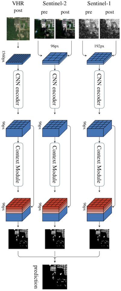
We propose a novel approach for rapid segmentation of flooded buildings by fusing multiresolution, multisensor, and multitemporal satellite imagery in a convolutional neural network. Our model significantly expedites the generation of satellite imagery-based flood maps, crucial for first responders and local authorities in the early stages of flood events. By incorporating multitemporal satellite imagery, our model allows for rapid and accurate post-disaster damage assessment and can be used by governments to better coordinate medium- and long-term financial assistance programs for affected areas. The network consists of multiple streams of encoder-decoder architectures that extract spatiotemporal information from medium-resolution images and spatial information from high-resolution images before fusing the resulting representations into a single medium-resolution segmentation map of flooded buildings. We compare our model to state-of-the-art methods for building footprint segme... [full abstract]
Tim G. J. Rudner, Marc Rußwurm, Jakub Fil, Ramona Pelich, Benjamin Bischke, Veronika Kopackova, Piotr Bilinski
AAAI 2019
NeurIPS 2018 Workshop AI for Social Good
[arXiv] [Code] [BibTex] [Media]
Bayesian Deep Learning for Exoplanet Atmospheric Retrieval
An ML-based retrieval framework called Intelligent exoplaNet Atmospheric RetrievAl (INARA) that consists of a Bayesian deep learning model for retrieval and a data set of 3,000,000 synthetic rocky exoplanetary spectra generated using the NASA Planetary Spectrum Generator.
Frank Soboczenski, Michael D. Himes, Molly D. O'Beirne, Simone Zorzan, Atılım Güneş Baydin, Adam D. Cobb, Yarin Gal, Daniel Angerhausen, Massimo Mascaro, Giada N. Arney, Shawn D. Domagal-Goldman
Workshop on Bayesian Deep Learning, NeurIPS 2018
[arXiv]
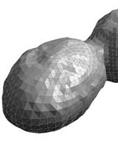
Using Bayesian Optimization to Find Asteroids' Pole Directions
Near-Earth asteroids (NEAs) are being discovered much faster than their shapes and other physical properties can be characterized in detail. One of the best ways to spatially resolve NEAs from the ground is with planetary radar observations. Radar echoes can be decoded in round-trip travel time and frequency to produce two-dimensional delay-Doppler images of the asteroid. Given a series of such images acquired over the course of the asteroid’s rotation, one can search for the shape and other physical properties that best match the observations. However, reconstructing asteroid shapes from radar data is, like many inverse problems, a computationally intensive task. Shape modeling also requires extensive human oversight to ensure that the fitting process is finding physically reasonable results. In this paper we use Bayesian optimisation for this difficult task.
Marshall, Sean, Cobb, Adam, Raïssi, Chedy, Yarin Gal, Rozek, Agata, Busch, Michael W., Young, Grace, McGlasson, Riley
American Astronomical Society (AAS), 2018
[Citation] [BibTex]
Automating Asteroid Shape Modeling From Radar Images
Characterizing the shapes and spin states of near-Earth asteroids is essential both for trajectory predictions to rule out potential future Earth impacts and for planning spacecraft missions. But reconstructing objects’ shapes and spins from delay-Doppler data is a computationally intensive inversion problem. We implement a Bayesian optimization routine that uses SHAPE to autonomously search the space of spin-state parameters, yielding spin state constraints within a factor of 3 less computer runtime and minimal human supervision. These routines are now being incorporated into radar data processing pipelines at Arecibo.
Michael W. Busch, Agata Rozek, Sean Marshall, Grace Young, Adam Cobb, Chedy Raissi, Yarin Gal, Lance Benner, Shantanu Naidu, Marina Brozovic, Patrick Taylor
COSPAR (Committee on Space Research) Assembly, 2018
[Blog Post (Adam Cobb)] [BibTex]

 All publications
 Bayesian Deep Learning
 Deep Learning
 Inference
 Data Efficient AI
 Adversarial and Interpretable ML
 Autonomous Driving
 Reinforcement Learning
 Natural Language Processing
 Space and Earth Observations
 Medical
 AI for Good and AI safety
